The Limbu
Limbuwan and the ten thums
Limbuwan was organised into thums — river-valley districts, most of them named for their kholas. The tradition of ten is universal in Limbu self-description; the archive is thinner than the tradition.
A thum was a territorial unit of historic Limbuwan, usually a river valley and usually named after its khola. Das Limbuwan — “the ten Limbuwan” — is how Limbus have described their country for as long as the written record reaches. A Tribhuvan University thesis is careful to call it exactly that: “the common belief that at one time in the early days there were ten Limbu rajas” Tribhuvan University e-library theses on Limbu ritual specialists and Limbu folklore E.
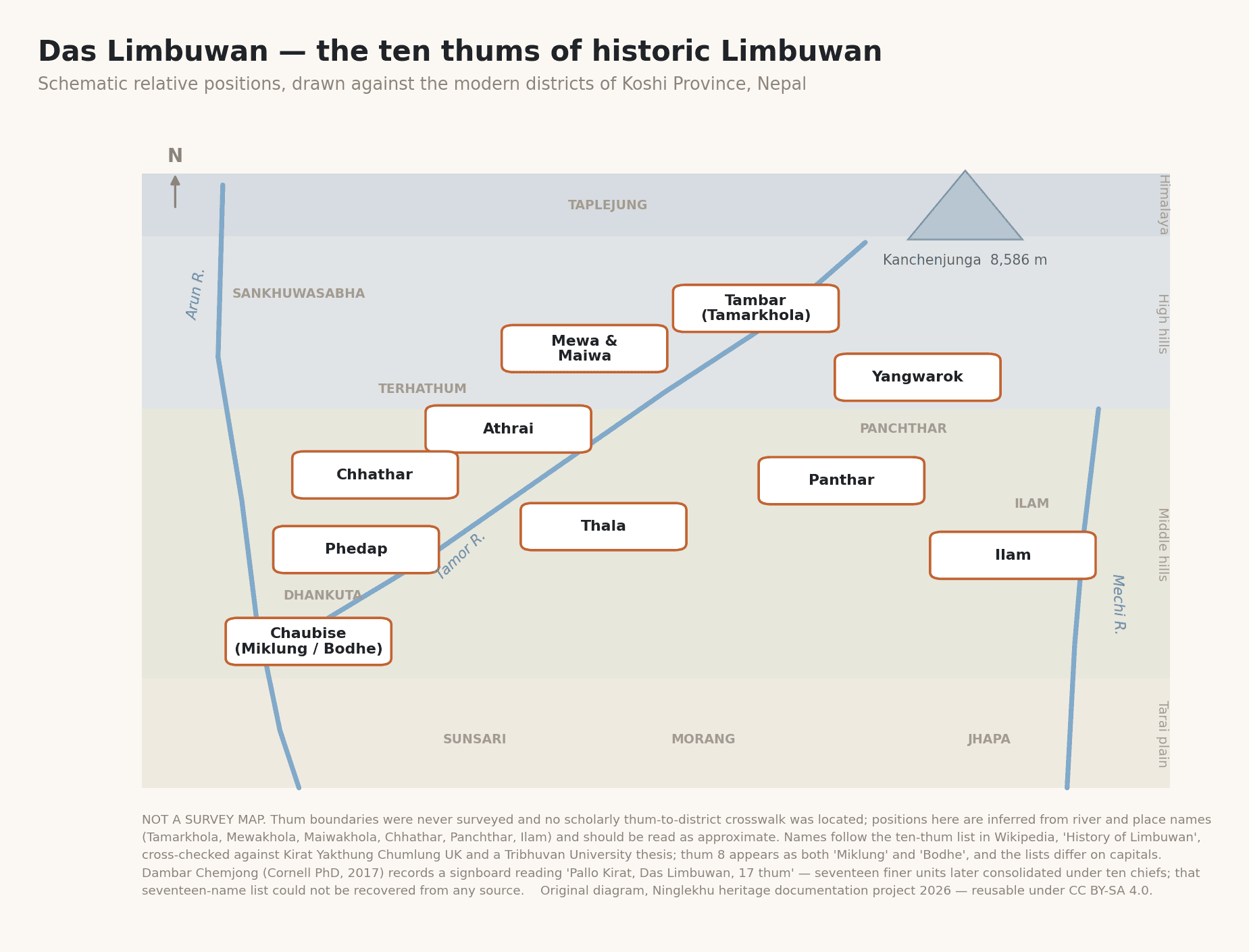
3. Schematic relative positions of the ten thums against modern districts. Not a survey map — see the caveats printed on the figure.

The ten thums
Three independent lists were cross-checked for this record: English Wikipedia’s “History of Limbuwan” English Wikipedia articles on the Limbu people, History of Limbuwan, Limbu language, Limbu script, Te-ongsi Sirijunga Xin Thebe, Phalgunanda, Rambahadur Limbu, Kirat Mundhum, Chasok Tangnam, Sakela, Chyabrung, Kirat Yakthung Chumlung, Federal Limbuwan State Council, Religion in Nepal and Kiranti languages, Kirat Yakthung Chumlung UK Kirat Yakthung Chumlung (Nepal), and Kirat Yakthung Chumlung UK, and a Grokipedia synthesis used only as a pointer. They converge almost exactly — which is itself informative, because they most likely all descend from Iman Singh Chemjong rather than being independent witnesses Chemjong, Iman Singh 1948–1974 D.
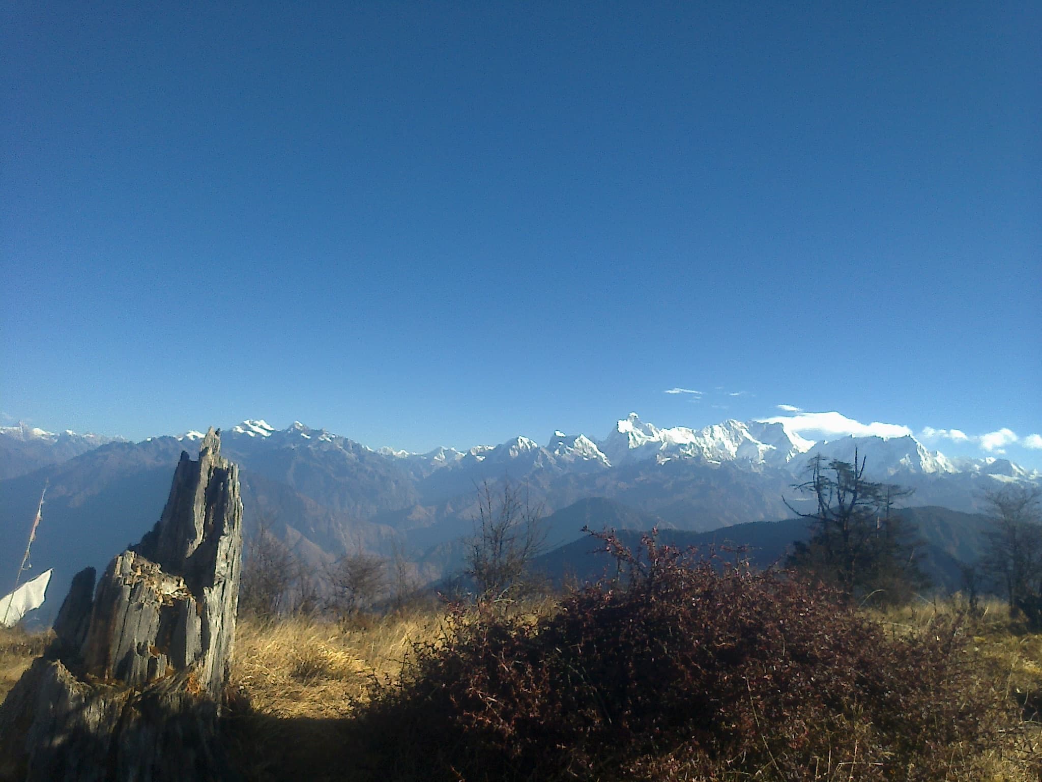
Kangchenjunga from Pathibhara in Taplejung — a contemporary view of northern Limbuwan. The landscape locates the discussion geographically; it is not evidence for the historical thum boundaries in the schematic above.

| Thum | Ruler named in tradition | Capital named in tradition |
|---|---|---|
| Tambar | Samlupi Samba Hang | Tambar Yiok |
| Mewa and Maiwa | Sisigen Sireng Hang | Meringden Yiok |
| Athraya (Athrai) | Thoktokso Angbo Hang | Pomajong |
| Yangwarok | Thindolung Khoya Hang | Hastapojong Yiok |
| Panthar | Ye Nga So Papo Hang | Yashok / Phedim |
| Phedap | Shengsengum Phedap Hang | Poklabung |
| Ilam | Mung Tai Chi Emay Hang | Phakphok |
| Miklung / Bodhe (Chaubise) | Soiyok Ladho Hang Chemjong | Shanguri Yiok |
| Thala | Tappeso Perung Hang | Thala Yiok |
| Chhathar | Taklung Khewa Hang | lists differ |
Contested
Ten thums, or seventeen?
The second reading reconciles the two elegantly — seventeen finer territorial units consolidated under ten ruling chiefs — but it is a reconciliation, not a documented fact.
Limbu tradition, as relayed by the three lists
ELimbuwan was Das Limbuwan: ten thums under ten rajas. The number is a fixed element of Limbu self-description Tribhuvan University e-library theses on Limbu ritual specialists and Limbu folklore.
Dambar Chemjong, Cornell dissertation (2017)
BHe records a Limbuwan signboard reading “Pallo Kirat, Das Limbuwan, 17 thum” and describes Limbuwan as “historically organized into seventeen administrative regions, later ruled by ten chiefs” Chemjong, Dambar Dhoj 2017.
Open question
BThe seventeen names have not been recovered
No source located names the seventeen units. Recovering that list — from Dambar Chemjong’s sources, from district records, or from an elder who can still recite it — is one of this project’s more frustrating open ends Ninglekhu/ku heritage documentation project 2026.
Negative finding
CChainpur is not one of the thums
“Chainpur” appears in some popular framings as a Limbuwan thum. It does not appear in any of the three ten-thum lists. It surfaces instead as a battle site of the Gorkha war, associated with the Sen kingdom of Chaudandi. The two have very likely been conflated with the thum of Chhathar Ninglekhu/ku heritage documentation project 2026.
Why the thums still matter
The thums were dissolved as administrative units long ago, but they did not disappear. Ethnologue’s list of Limbu dialects — Panthare, Phedappe, Tamorkhole (Taplejunge), Chaubise (Charkhole), Chhatthare, Yanggrokke — maps directly onto the thum names above Limbu [lif] C. The dialect geography is the political geography, which is a striking and under-remarked continuity.
For a clan record the practical consequence is direct: which thum a family traces to is the single most useful geographic fact it can contribute, and no archive holds it. The contribute page explains how to send one.
Sources for this page
Peer-reviewed scholarship
Institutional or community publication
- C
English Wikipedia articles on the Limbu people, History of Limbuwan, Limbu language, Limbu script, Te-ongsi Sirijunga Xin Thebe, Phalgunanda, Rambahadur Limbu, Kirat Mundhum, Chasok Tangnam, Sakela, Chyabrung, Kirat Yakthung Chumlung, Federal Limbuwan State Council, Religion in Nepal and Kiranti languages. English Wikipedia.
- C
- C
- C
Ninglekhu/ku heritage documentation project (2026). The Ninglekhu of Limbuwan: A source-critical history of a Yakthung clan, and of the people it belongs to. Ninglekhu/ku heritage documentation project (v1.0, 22 August 2026).
Twentieth-century Kirat historiography
- D
Chemjong, Iman Singh (1948–1974). Kirat Itihas (1948); Kirat Sahityako Itihas (1955); Kirat Folklore (1961); Kirat Mundhum (1961); Limboo–Nepali–English Dictionary (1961); Kirat History and Culture (1967); Kirat Darshanko Saransh (1969); Bijayapurko Itihas (1974).